The biennial Schumm reunion is this weekend, 102 years of Schumm reunions, the 46th reunion. In commemoration of the John George Schumm family, I am sharing the talk I presented at the 2024 reunion, Our Sensational Schumm Family.
For that 2024 reunion, the 100th year anniversary of the Schumm reunion, we published an updated Schumm genealogy. During the research for that book, I came across many interesting stories and facts about Schumm family members. Much of that information came from obituaries and newspaper articles, on which I based my talk.
John George Schumm’s descendants number in the thousands and live all over the U.S., so I could only mention a few in my talk. I do not give the surnames of living family members in some cases.

2024 Schumm Reunion group photo
The Schumm history in America began in 1833, when John George Schumm and five of his children immigrated to America from Ruppertshofen, Wuerttemberg. In 1838 they settled in Van Wert County, at what would become Schumm, Ohio.
The John George Schumm family has a strong Lutheran heritage that has continued through ten generations of Schumms in America, creating generations of life-long Lutherans across America.
Marjorie L. (Gunsett) Loveless’ 2018 obituary said it very well: “Marge and her two siblings were raised with a strong Lutheran influence…”
Descendants of John George Schumm travel long distances to see and visit the Schumm settlement area and the Schumm church and cemetery. A few years ago a couple from across the country made a special trip to visit Schumm and he wore a shirt with the Luther Rose symbol on it. I was not surprised.
Because of this Lutheran heritage, there have been over 65 ministers in the family. Most of them are descendants of John George Schumm, while a few married into the family. Most of them were Lutheran Church Missouri Synod pastors.
Each of the five Schumm immigrant children have ministers in their family lines. Some of the family’s earliest ministers:
Grandsons of John George Schumm, first generation Schumms who were born in America:
- Georg M. Schumm (1841-1917), son of George Martin Schumm. His son, Rev. Paul Theodore Schumm (1887-1953) was also a minister.
- George Conrad Ferdinand Schumm (1864-1926), son of Johann Friedrich Schumm.
Great-grandsons of John George Schumm. They did not have the Schumm surname, but their mothers were Schumms:
- Dr. John Jacob Friedrich Schinnerer (1865-1950), son of Mary Schumm & Martin Schinnerer, and a grandson of George Ludwig Schumm. Two of Rev. Dr. Schinnerer’s sons became Lutheran ministers, Rev. Carl August Schinnerer (1889-1952), and Rev. Dr. Otto Paul Schinnerer (1890-1942) (WWI veteran).
- Francis Lankenau (1868-1939), son of Katherina Schumm and Henry J. Lankenau), and grandson of Johann Jacob Schumm. Rev. Lankenau was the editor of The Lutheran Pioneer, President of LCMS, Ohio & other states, Pastor at Napoleon, Ohio, who died just as he was about to speak at a Walther League Conference in Kansas City in 1939.
- Johann Ludwig Roehm (1881-1975), son of Anna Rosina Schumm & John Roehm, and grandson of George Martin Schumm.
Great-great-grandsons of John George Schumm:
- Twin brothers, Rev. Oscar Linnemeyer (1891-1984) and Rev. Otto Linnemeier (1891-1967), sons of Henry Dietrich Linnemeier and Catherine Bienz, grandsons of Magdalene Schueler and John Bienz, and great-grandsons of Maria Katherine (Schumm) Schueler.
These are just few. There were many more ministers in the family throughout the years.
I am sure that John George Schumm would be very pleased to know that his faith and values have been passed on for over 190 years.
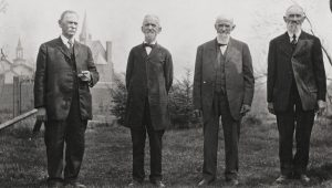
Dedication of Zion Lutheran Church, Schumm, 1915. H.G. Schumm, Rev. Geroge M. Schumm, Louis M. Schumm, J.F. Schumm.
There have been many veterans in the John George Schumm family.
Some who made the ultimate sacrifice while serving their country:
Civil War:
- Daniel Schumm (1840-1863), 52nd OVI, son of Johann “Jacob” & Hannah (Billman) Schumm.
- John Schumm (1843-1864), 60th OVI, son of George Martin & Maria (Pflueger) Schumm.
WWI:
- Karl Schumm (1894-) KIA in France, son of Rev. Ferdinand & Wilhelmina (Brockmeyer) Schumm.
WWII:
- Edgar Schumm (1914-1944) KIA in France, son of William & Amanda (Reidenbach) Schumm.
- PFC Victor Schueler (1924-1945) died in Italy, 10th Mountaineer Division, son of Adolph & Marie (Limbach) Schueler.
Korean War:
- PFC Emanuel George Roehm (1931-1951), KIA in Korea, 1st Marine Division, Purple Heart + 5 other service medals, son of Emanuel George & Esther (Ohnesorge) Roehm.
During WWII, there were about 14 men from Zion Lutheran Church at Schumm who served in the military.
- Milton Schumm (1921-2009), was reported missing in action for a week after being isolated from his group while guarding a bridge.
- Donald W. Schumm (1922-2009), a veteran who owned D & R Hardware in Willshire, was a member of Willshire’s American Legion for 65 years, presented 52 American flags at burials, and played taps.
- Louis Allmandinger (1925-2013) Army Paratrooper, 11the Airborne, WWII Occupation, Japan.
- Walter Louis Schumm (1923-2012), Purple Heart recipient. He sang in barber shop quartet.
Adolph M. Scare (1932-2004), Chief Medical Aidman, wounded in action by a missile in 1953, was hospitalized and returned to service. He was the recipient of 8 service medals and the Purple Heart.
Walter A. Scare (1929-2022) [brother of above], Korean War veteran, took part in the 2015 Honor Flight, was a Meals on Wheels volunteer.
Emanuel Schumm (1892-1973) and his brother Emil Schumm (1893-1960), both served in WWI.
Allan Michael Loveless (1940-2008) served 23 years in U.S. Air Force.
Bradley Spahr & Lt. Douglas Schueler were appointed to U.S. Naval Academy at Annapolis.
Five Lankenau brothers, sons of Rev. Francis J. Lankenau & Helen Beeke, served in the military:
- Wilfred E Lankenau (1901-1989), Naval Captain from 1924-1954
- Norman Herbert Lankenau (1910-1979), 1932 West Point graduate, career Army officer.
- Alfred Henry Lankenau (1893-1958)
- Harold George Lankenau (1899-1953)
- Otto Lankenau (1906-1987)
The Schumm women also played their part in the military:
Rosina (Germann) Schaadt (1874-1955) of Lima, received a medal for Red Cross work during WWI.
Katharine Skiba (1948-2008), U.S. Army Veteran, serving from 1967-1970.
Erna Clara (Lankenau) Bemont (1912-1958), was in the Army Nurse Corps and was Supervisor of nursing at Northwestern University. Her husband Lt. Col. Richard Bemont (1911-1968) was career military (WWII & Korea). Both are buried at Arlington National Cemetery.
A number of other Schumm veterans and their wives are buried in National Cemeteries across the country.
Members of the John George Schumm family who were veterans and who are buried in Zion Schumm’s cemetery:
William Otto Baker (1933-2009) U.S. Army, Korea
Edgar Jacob Dietrich (1915-1996) U.S. Army, WWII
Henry Walter Dietrich (1922-2005) U.S. Army Air Corps, WWII
Marvin J. Grote (1936-2022) U.S. Army Reserves
Edward Theodore Gunsett (1891-1973) U.S. Army, WWI
Paul Lawrence Hofmann (1913-1977) U.S. Army, WWII
Paul A. Roehm Jr (1929-1968) U.S. Army, Korea
Donald T. Salway (1927-1993) U.S. Army, WWII
Harold F. Salway (1925-1996) U.S. Navy, WWII
Pvt. Edgar F. Schumm (1914-1944), WWII, died in France
Emanuel H. Schumm (1892-1973) Ohio Prov Guard Co, WWI
Frederick J. Schumm (1933-2015) U.S. Army, Korea
Harold P. Schumm (1921-1988) U.S. Army Air Corps, WWII
Oswald H. Schumm (1902-1987) U.S. Army, WWII
Richard E. Schumm (1922-1990) U.S. Marines, WWII
Roman C. Schumm (1924-1988) U.S. Army, WWII
Palmer L. Schwartz (1928-2010) U.S. Army
Emanuel Schumm WWI
Many members of the John George Schumm family seem to have a music gene, if there is such a gene. This talent has produced a number of musicians in the family.
Otto Henry Schumm (1883-1981) was a parochial schoolteacher and church organist.
Martin A. Schumm (1926-1997) sang in a barbershop quartet.
Jane Ann (Schumm) Buchanan (1921-2023) graduated from the St. Louis Institute of Music and taught piano.
Vanessa Ruth (Schumm) W. was a Capital University graduate and performed with the Columbus, Ohio, Symphony Opera Company.
Rev. Herbert Ivan Schumm (1928-2018) became the pianist and organist for the Willshire Church of God at age 12 and sang baritone in the choir. His wife was also a minister.
Rev. Herbert Ivan Schumm’s sister Mary Schumm (1920-2016) played the harp, organ, and other instruments. She was my first organ teacher.
I started playing church organ at Zion Chatt in 1965, when I was 13, and I still play for the worship service every Sunday. I like to say that a church organist’s pay isn’t all that great, but the job security and heavenly rewards are great.
Velma Louise Schumm (1914-2016) was the organist at Zion Schumm for many years and was the organist for my parents’ wedding in 1950.
Ferdinand Schinnerer (1876-1949) started a church camp in California and his daughter Edna Sophie (Schinnerer) Ohlendorf (1904-1995) later established a summer music camp there.
Jason S. was an Elvis impersonator.
Schumm family members love to sing and always sing at the Schumm reunion.
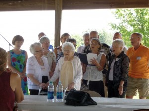
The Schumm Singers, with Velma, 100, conclude the reunion with song. (2014 photo by Karen)
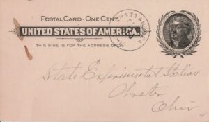
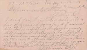
There have been a number of Schumm postal employees over the years. There was a Post Office at Schumm from 1881-1953 and the first four postmasters and the last postmaster were Schumms.
Martin J. Schumm was appointed the first Schumm postmaster on 31 December 1881. Henry Schumm was appointed in 1885, George F. Schumm, was appointed in 1885, Henry M. Schumm was postmaster from 1886-1903, and Emanuel Schumm (1892-1973), was the last postmaster at Schumm, for 13 years, from 1940-1953.
Other Schumm family postmasters were Walter Herbert Schueler Jr. was a mail carrier in Fort Wayne in 1950, Otto L. Acker (1912-1963), a letter carrier in Whitley County, Indiana, and Otto E. Lankenau (1906-1987), a postmaster at Napoleon, Ohio, in 1957.
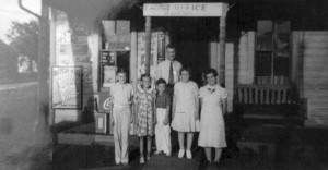
Schumm Post Office, c1930.
A number of family members went into the medical profession, and I found this story from Los Angeles interesting. The wife of Schumm descendant Dr. David S., DDS, was a model and actress who helped put David through dental school. She starred in TV shows such as Emergency!, Adam-12, Laugh-In, Bob Hope Special, Tonight Show, and the Dean Martin Show. Her biggest role may have been when she played a chair, one of the Furniture Girls, in the 1972 sci-fi movie Soylent Green, which starred Charlton Heston.
Other interesting Schumm occupations and activities:
Schumm family hero, Vance F., pulled his nephew from the jaws of a shark in Florida, by grabbing the shark’s tail. The boy’s arm was bitten off, recovered from the shark, reattached, and he survived.
Dr. Robert F. Stamm (1915-2001) was a research physicist, atomic bomb researcher and principal flutist with the Connecticut Symphony Orchestra.
Richard Moellering Sr. (1940-2018) was a civil engineer who medaled in the Senior Olympics at age 77, a year before his death.
Dr. Harold Moellering (brother of above) was a professor of geography at The Ohio State University.
Herbert C. Roehm (1912-1997) worked for NASA.
Dr. Otto Paul Schinnerer (1890-1942) was an associate professor of German, the editor of Germanic Review at Columbia University, and wrote 2 standard college texts.
Gayle Forbes (1931-2023) was a rapture rescuer and had great horned owl for years that lived on a roost on top of her refrigerator. She worked for Lockheed.
Lorenz G. Schumm (1891-1959) was a historian and wrote books on the Civil War and northern Indiana history. He was the founder and president of the Chicago Civil War Round Table.
Paul R. Lankenau (1904-1982) was the director of athletics at Valparaiso University, the mayor of Napoleon, Ohio, and Napoleon Man of Year in 1968.
Fredrick Emil Schumm (1925-2012) was a WWII Veteran, Fullbright Scholar, and master sculptor.
John W. Gunsett (1931-2009) attended the Indy 500 over 50 times.
Robert Oscar Lankenau (1919-2000) was a chemist, attended Indiana School for the Deaf, and was was Co-founder and president of several state and national deaf associations. His wife Betty (Martens) was a member of some of the same deaf organizations.
Herman Andrew Schumm (1893-1984) was a painter and steeplejack who painted steeples in the Syracuse, New York area for over 30 years.
Lorenz Herold “Dick” Germann (1925-2015) was a member of the Old-Fashioned Farmer’s Association and past president of Van Wert Community Concert series.
Lillian Marie (Koenemann) Huener (1926-2009) ran an in-home typing service and was the first in her family to have an email address.
Arthur J. Bienz (1905-1989) was an assistant brewmaster in Pennsylvania and his 2nd cousin George Louis Schumm (1884-1950) was on the Pennsylvania Liquor Control Board.
Herbert A. Schumm (1922-2013) worked for NBC in New York City.
Verna E. (Meyer) Zink (1925-2014), of Fort Wayne, received the WANE TV award for work at the FWPD Victims Assistance Program. In the 1940s she was a softball catcher on the state and city championship teams and played on the City Lights championship basketball team.
John Martin Schumm (1873-1954) was a marshal and constable for 20 years.
Don A. Germann was an electrical engineer, a computer systems analyst with California Institute of Technology jet propulsion lab in Pasadena.
Ludwig W. Christman (1895-1988) was a stockbroker in Connecticut.

This is just a fraction of our Sensational Schumm family. A family of farmers, ministers, educators, health care professionals, veterans, musicians, quilters, postal workers, factory workers, scientists, technicians, athletes, engineers, artists, writers, carpenters, gardeners, and good cooks. All good hard-working people.
It matters to most of us that we are not entirely forgotten when we die, but that our names are still spoken and that we are remembered.
You can contact Karen at karen@karenmillerbennett.com
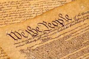
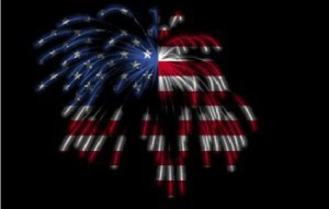
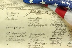
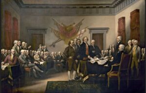
 July Fourth 2026 is the 250th anniversary of the Declaration of Independence, when the Continental Congress officially adopted the Declaration of Independence and declared that the Thirteen Colonies were no longer part of Great Britain, but were independent sovereign states and were part of a new nation.