
Last week I wrote about Google Earth and posted some area photos that I screen captured while looking around in the program. It is interesting to look at the photos from various years and different views on Google Earth. This week I have some photos of Chattanooga, Ohio, from Google Earth.
Google Earth’s most recent aerial view of Chattanooga was taken 26 February 2012. Chatt’s downtown area looks pretty much the same today as it did in 2012. The Chatt Bar is in the left center of the photo below. Notice that the 2012 aerial view shows a vacant lot to the south of the Chatt Bar.
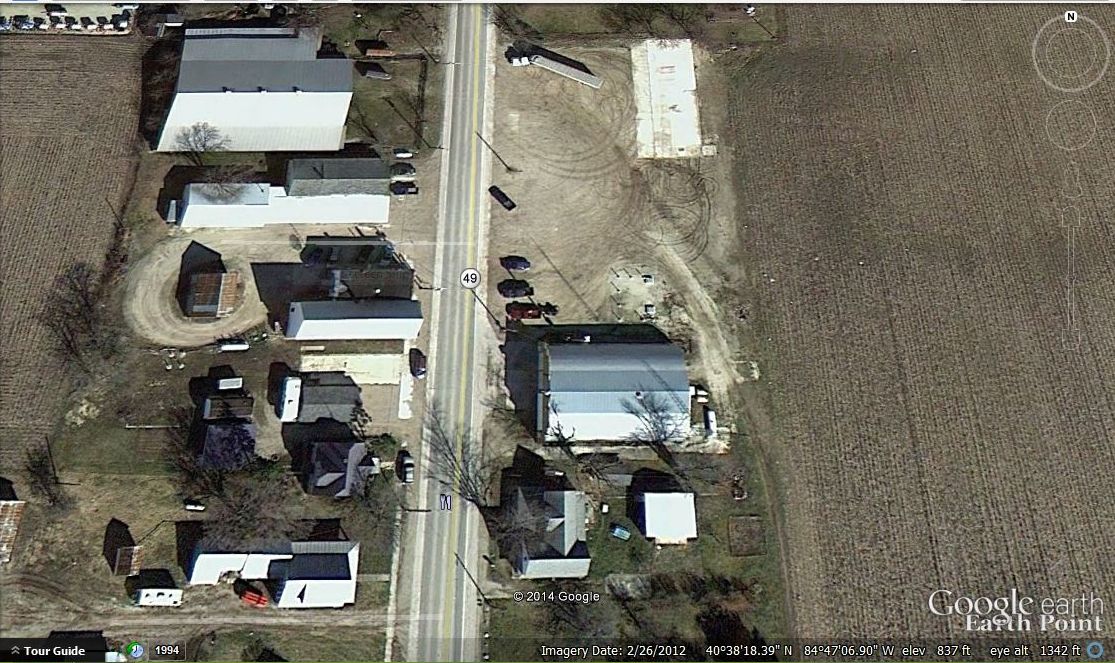
Chattanooga, Ohio, Google Earth, 26 Feb 2012 photo.
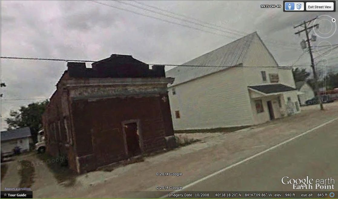
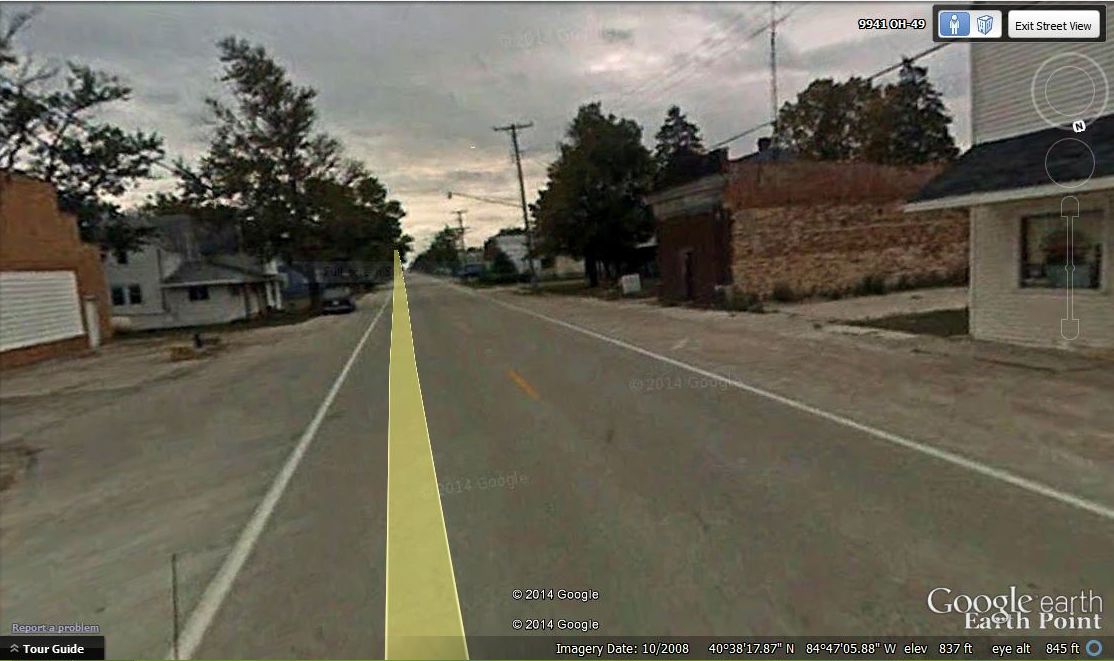
But when I switched to Google Earth’s Street View in front of the Chatt Bar I got a big surprise. I noticed that the aerial view and the street view were taken at different times. The street view photos were taken October 2008, four years before the aerial photos were taken. And I noticed something very interesting in the photos. The old brick building, once located south of the Chatt Bar, was still standing in October 2008 and it can still be seen in Google Earth’s Street View photos.
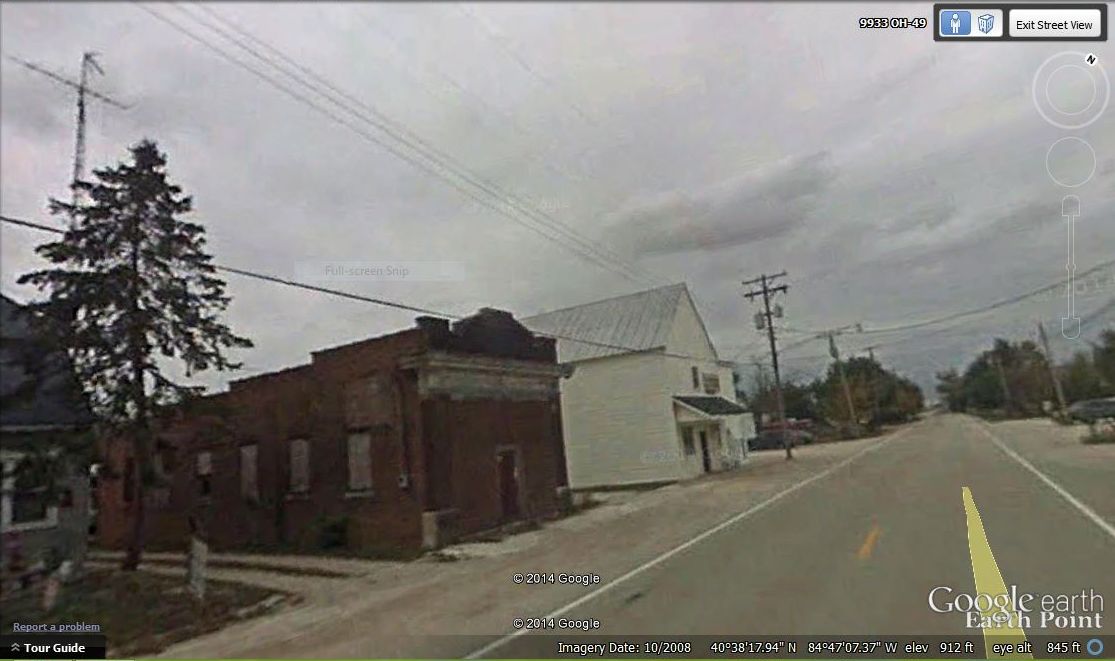
Brick building & Chatt Bar, looking north, Google Earth, October 2008 photo.
That old brick building was once the Chattanooga Bank. Yes, Chattanooga had a bank at one time–the Farmers & Merchants State Bank. It was in business by 1917 and closed about 1930. A plat map of Chatt from the 1920s shows the bank was south of the hotel and bar. Semon Egger’s property and businesses were between the two.
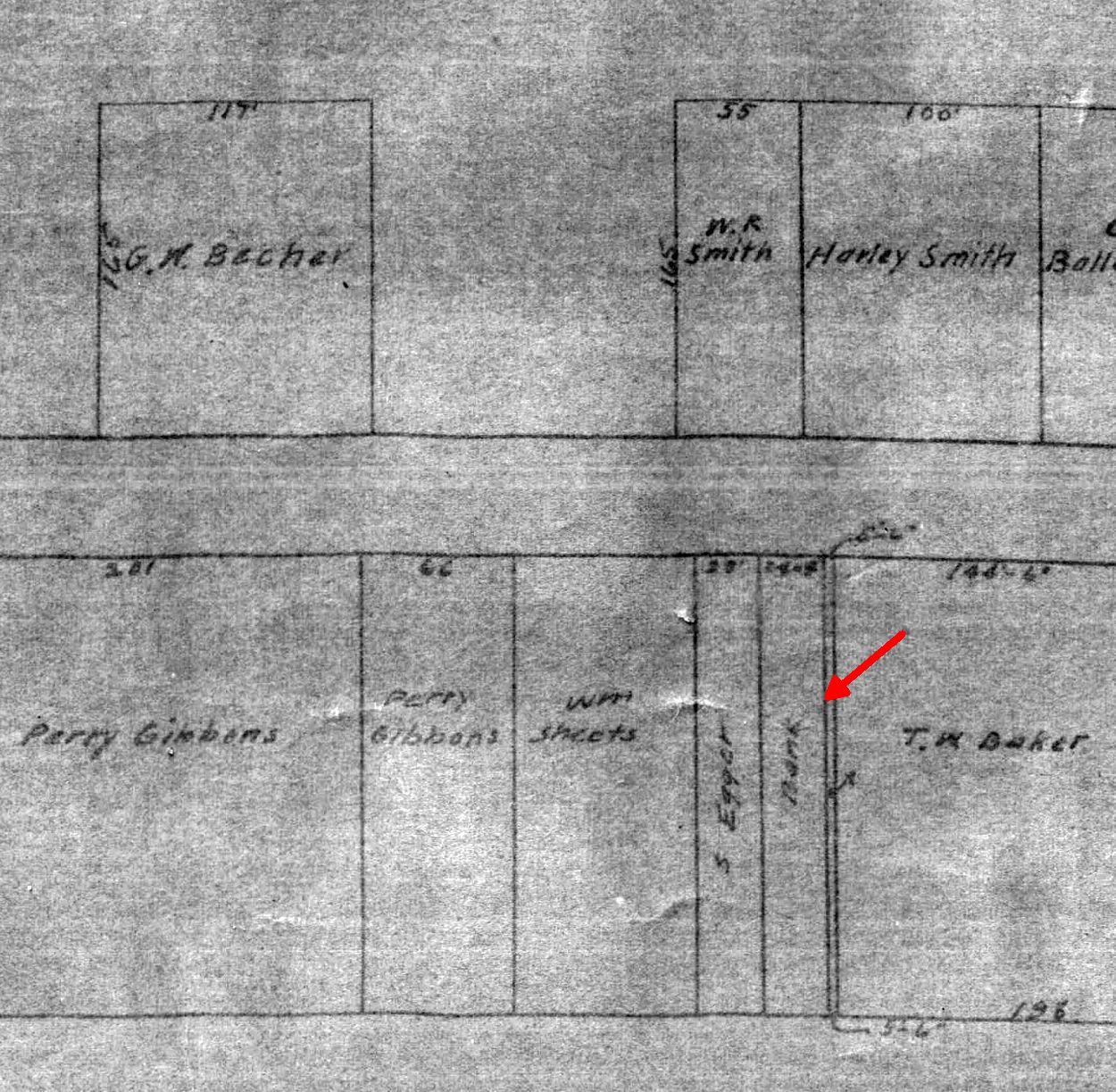
Part of Chatt Plat Map, c1920s, showing Chatt Bank.
A document from the Chattanooga Farmers & Merchants State Bank, dated 1917.
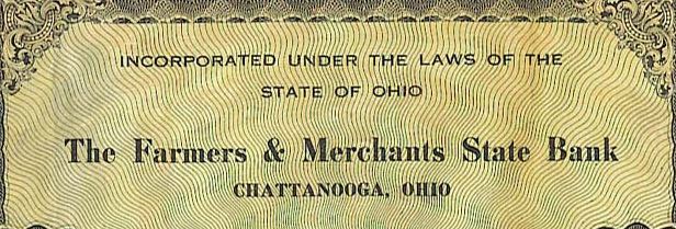
Farmers & Merchants State Bank, Chattanooga, Ohio, 1917.
The brick bank building later housed two grocery stores, Heffner’s Grocery and then Bollenbacher’s Grocery.
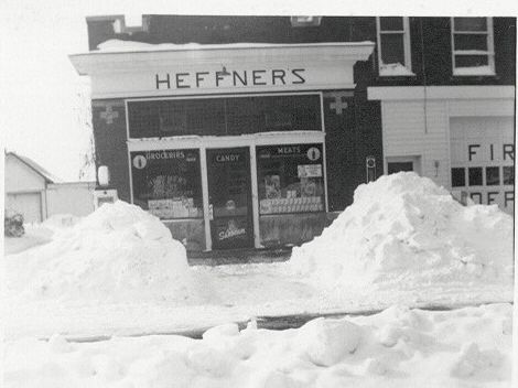
Heffner’s Grocery, Chattanooga, Ohio, undated photo.
By studying Google Earth’s aerial maps of Chatt I was able to determine that the old brick building was torn down between July 2009 and August 2010. Someone from Chatt probably knows the exact date.
Chatt Bank/Grocery & Chatt Bar. Google Earth, October 2008 photo.
At one time there was another building between the Chatt Bar and the brick building. That building was Semon Egger’s grocery, which also included the Chattanooga Post Office and Egger’s mortuary, which was upstairs.
When I was a child that building was the home of the Chattanooga Volunteer Fire Department. At that time there was a large garage door on the ground level and the Chatt Chums 4-H Club would sometimes meet upstairs. Back then we had no idea the second floor had once been a funeral parlor.
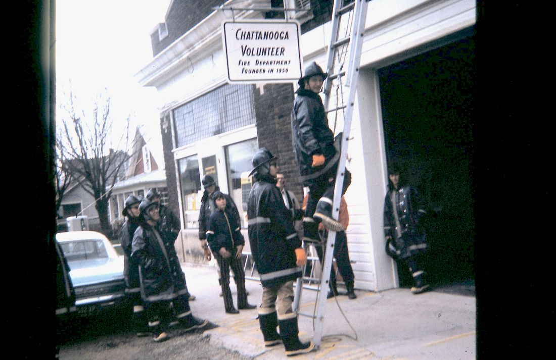
Chattanooga Volunteer Fire Dept, undated photo, c1970s, courtesy of Jerry Miller. The building was once Egger’s store. Notice the former bank building to the left.
Today Chatt’s Fire Department is across the street, in the building that once was Wendel’s Garage and Auto Sales. My parents purchased Pontiac autos from them years ago. Below is a Google Earth photo of that building as it looked in 2008.
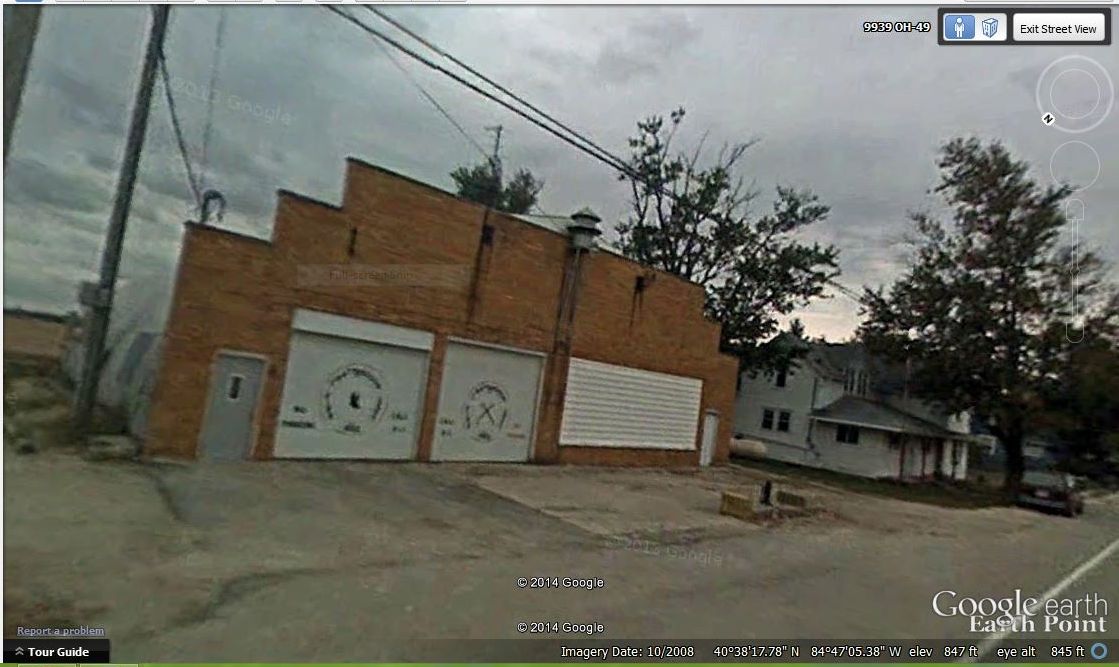
Google Earth, October 2008 photo.
I am grateful that the 2008 Street View images of Chatt still remain on Google Earth and that I am able to see that old brick building once again.
Chatt Bar and Bank, looking south, Google Earth, October 2008 photo.
I did not have a photo of the brick structure before they tore it down, but I do now, thanks to Google Earth.
(All images accessed from Google Earth 30 April 2014.)

6 comments
Skip to comment form
For a brief time during the 1980s there was a small grocery store in what I believe was the buliding you’re referring to.I think it opened shortly after Link’s closed by a family that lived in town — I don’t recall the family’s name. I think that was when I first learned about the Bollenbachers’ grocery store from Harold and Martha.
Author
I am sure you are correct but I cannot remember who that was. Maybe another reader will remember. You think you will always remember these things, but time moves on and memories fade…
I remember going to a record hop which I believe was on the top floor of Eggars grocery. Not sure. I don’t know who sponcered the dance. It may have been the volunteer firemen. Does anyone remember the event? I was going into 7th grade which was the first 7th grade in the Parkway consolidated school system. I was a “Rockford Kid” but knew most of the “Willshire Kids” because I attended Bible School held in the Willshire school.
Author
I don’t ever remember a record hop up there but I believe the Chatt Chums 4-H club met there occasionally. Maybe someone will remember the dance.
I was told that many years ago my grandpa and great uncle operated a grocery store in Chatt. Their names were Herman Lavire Patterson and Loris Minger. Does anyone have any information about this store?
Author
Those name are not familiar to me but someone may recognize them. We will see. Thanks for writing!