
The past couple weeks I have shown some 1910 plat maps of Blackcreek Township. While at the courthouse I did not find 1910 maps of Liberty Township, nor do I have Liberty Township’s 1910 Quadrennial Assessor’s Report.
However I did find the 1914 Appraiser’s Plat book for Liberty Township, Mercer County, Ohio. The maps in this book are not quite as neat as those in the Blackcreek book but they are still very interesting and helpful in locating someone’s property.
1914 Appraiser’s Plat, Liberty Township, Mercer County, Ohio.
Liberty Township is immediately south of Blackcreek Township, with Indiana on its west side, Washington Township on its south side, and Hopewell Township to the east. Chattanooga is in the northwest corner of Liberty Township, between sections 5 and 6.
Today I have posted sections 5, 6, 7, 8, 17, and 18 in Liberty Township. State Route 49 runs between sections 5 and 6, 7 and 8, and 17 and 18. Below is a current map of the Liberty Township to aid in locating the sections.
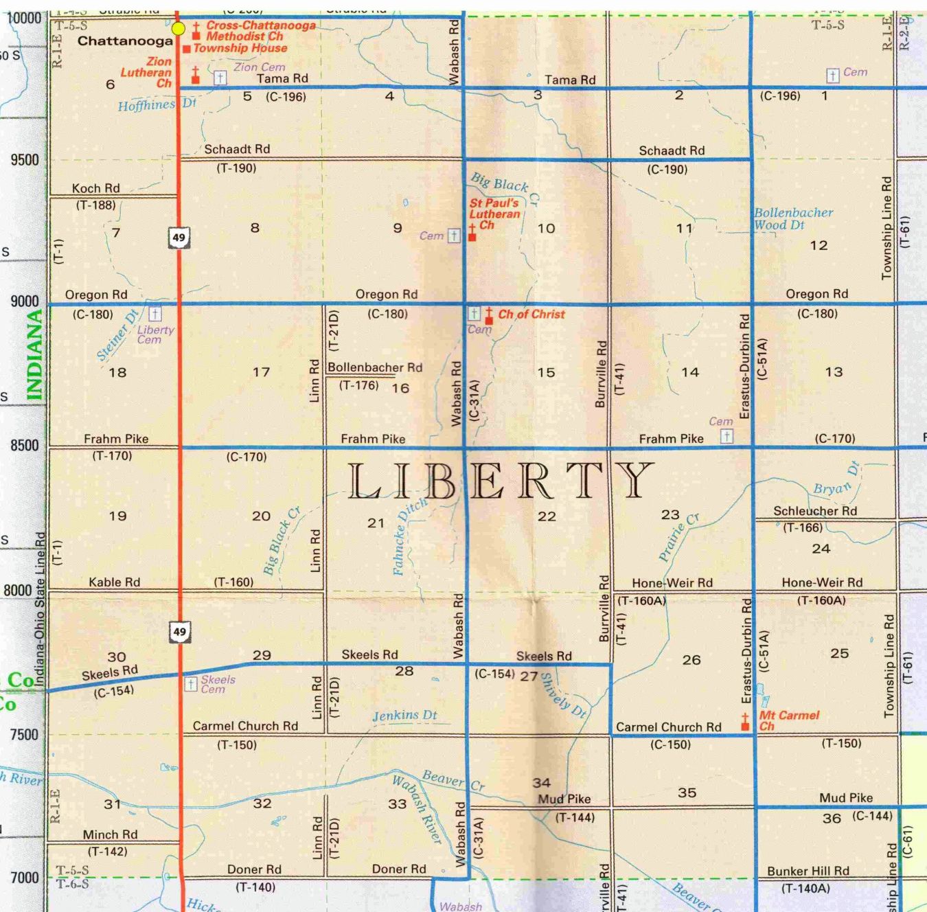
Liberty Township, Mercer County, Ohio.
Section 5 is bounded by Strable Road and Blackcreek Township on the north, State Route 49 on the west, Schaadt Road on the south, and section 4 to the east. Tama Road runs through the center of section 5. Zion Lutheran Church is located on the west edge of section 5, in the middle of the section, on the corner of State Route 49 and Tama Road. In addition to the Lutheran church the map shows Zion’s cemetery on Tama Road, as well as the parsonage and the church school south of the church on route 49.
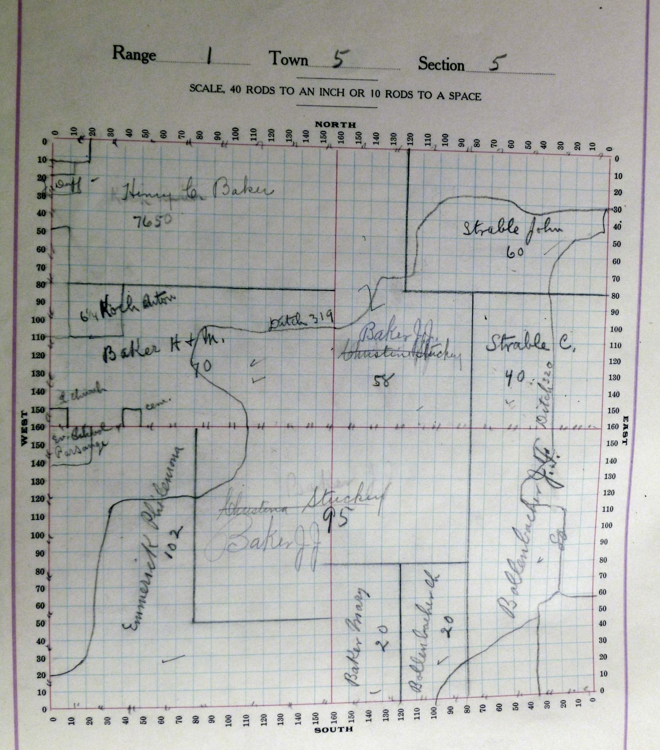
Section 5, Liberty Township, 1914 Appraiser’s Plat Book.
The east side of section 6 is the west side of Chatt. Section 6 is bounded by Strable Road and Blackcreek Township on the north, Indiana on the west, section 7 on the south, and State Route 49 on the east.
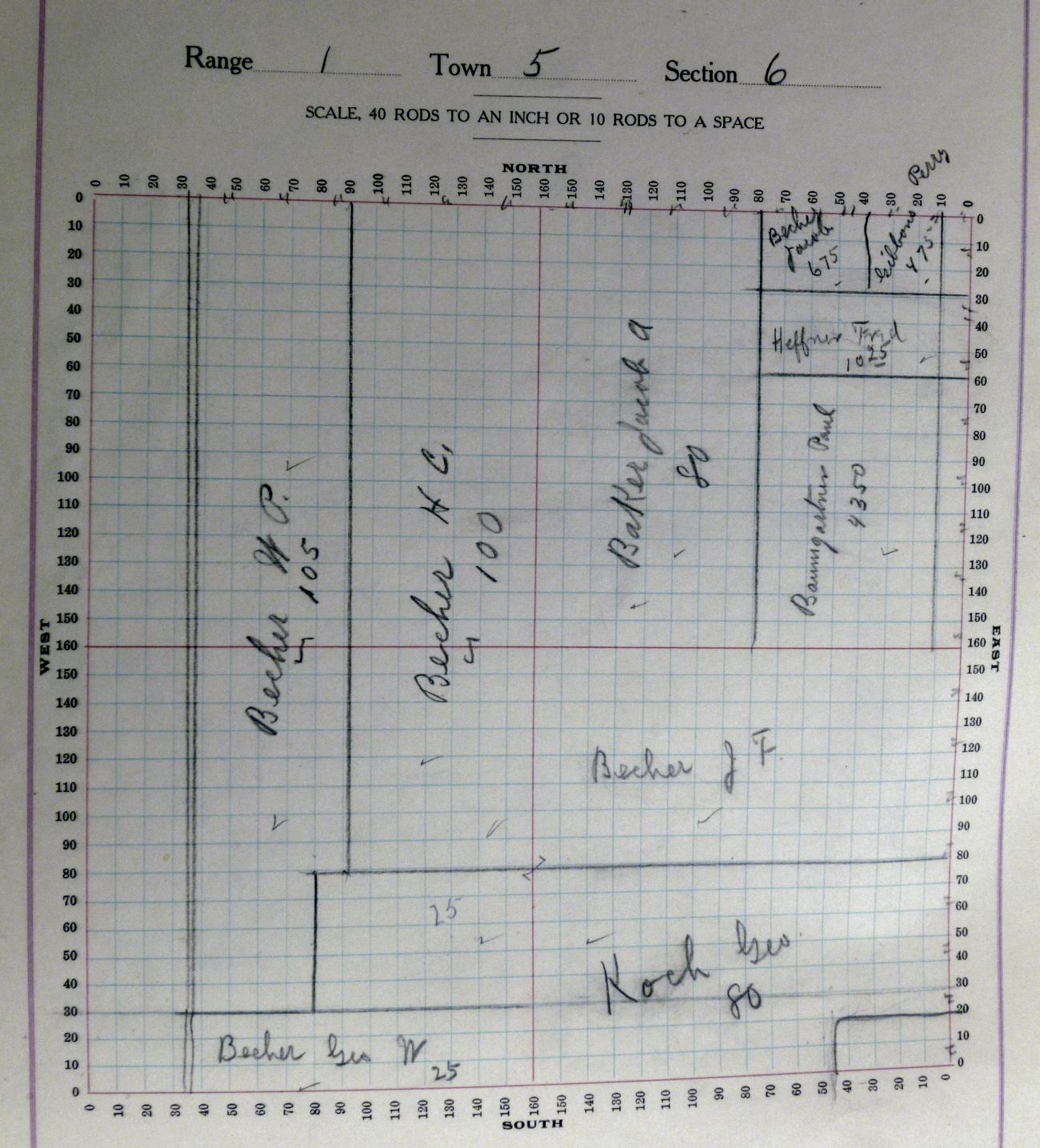
Section 6, Liberty Township, 1914 Appraiser’s Plat Book.
Section 7 is south of section 6. Indiana is on the west side and Route 49 is on the east side. Oregon Road is at the south end of sections 7 and 8.
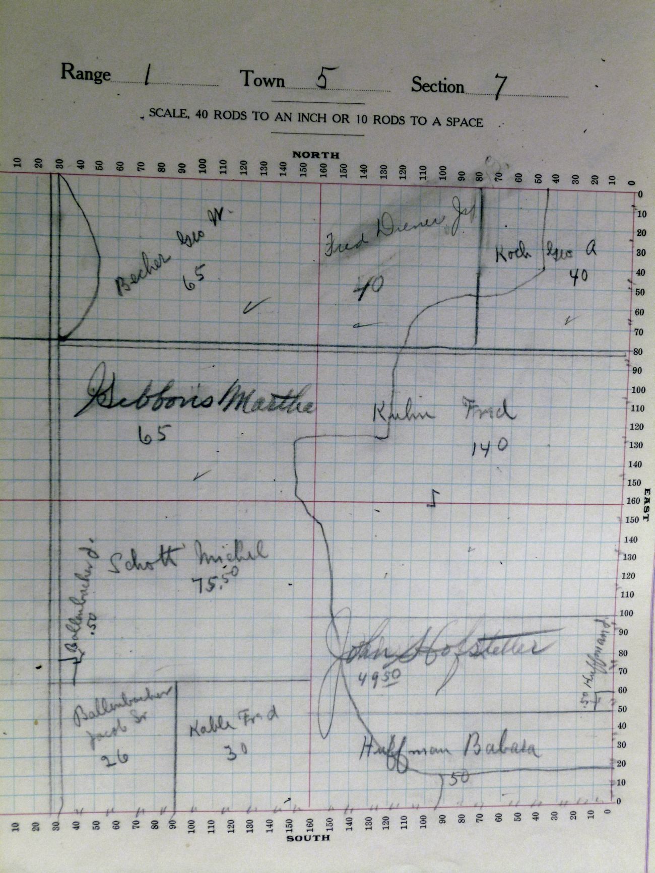
Section 7, Liberty Township, 1914 Appraiser’s Plat Book.
Section 8 is east of section 7 and is bounded by Schaadt Road to the north, 49 to the west, and Oregon Road to the south. Chatt School was on the northwest corner of section 8, at the corner of 49 and Schaadt Road.
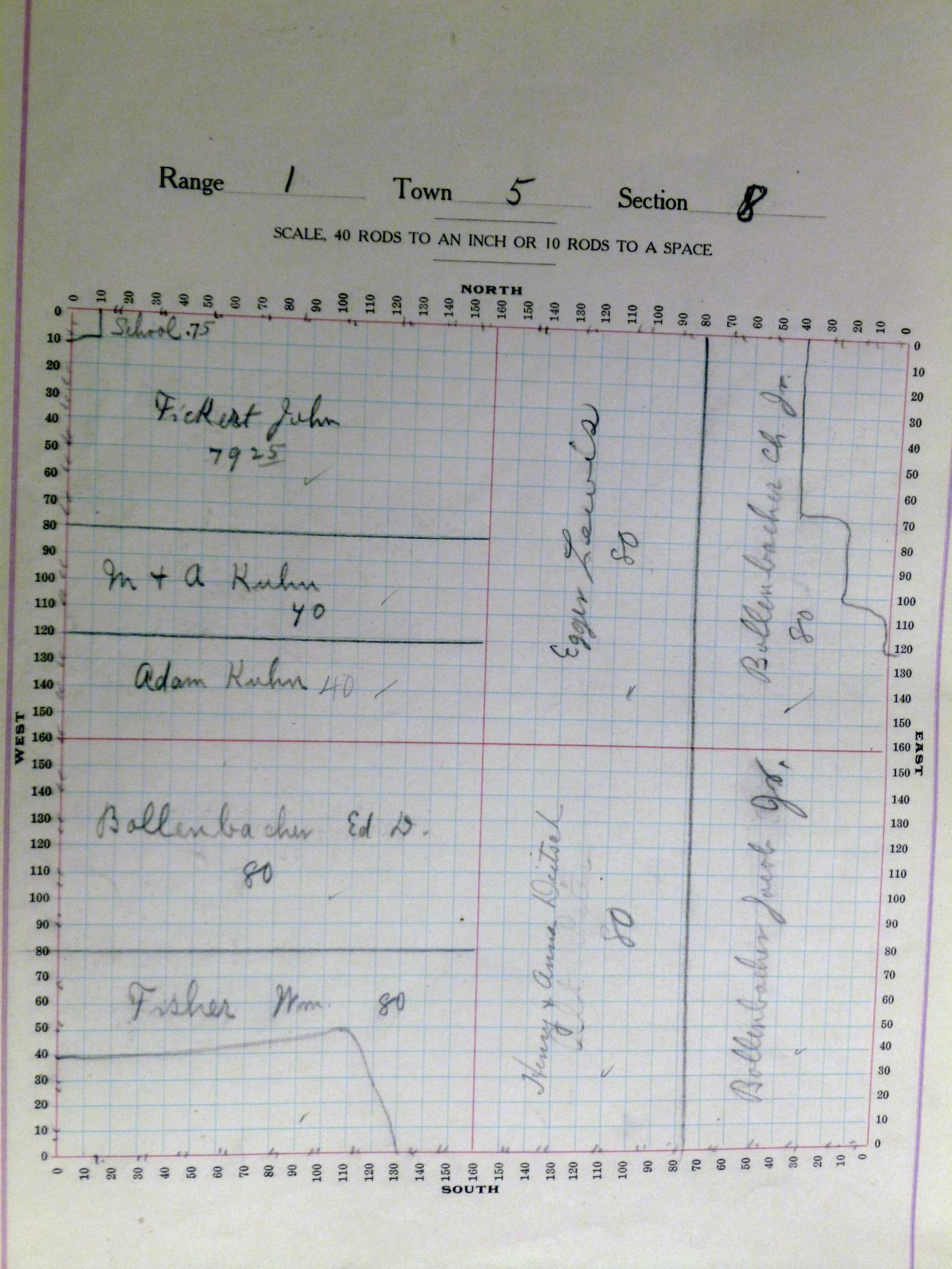
Section 8, Liberty Township, 1914 Appraiser’s Plat Book.
Section 17 is south of section 8 and is bounded by Oregon Road to the north, 49 to the west, Frahm Pike to the south, and Linn Road to the east. There was a school in the southwest corner of section 17, at the corner of 49 and Frahm Pike.
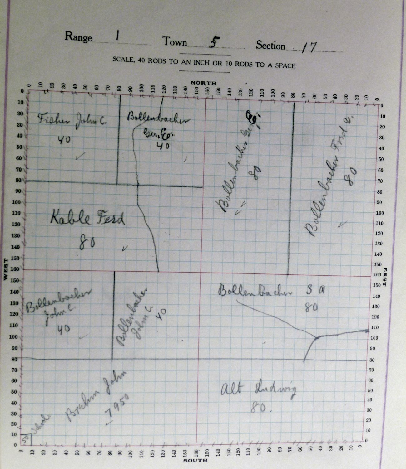
Section 17, Liberty Township, 1914 Appraiser’s Plat Book.
Section 18 is west of section 17 and south of section 7. It is bounded by Oregon Road to the north, Indiana to the west, Frahm Pike to the south, and 49 to the east. Kessler Cemetery, aka Liberty Cemetery, is not shown on the 1914 map but is in the northeast portion of section 18.
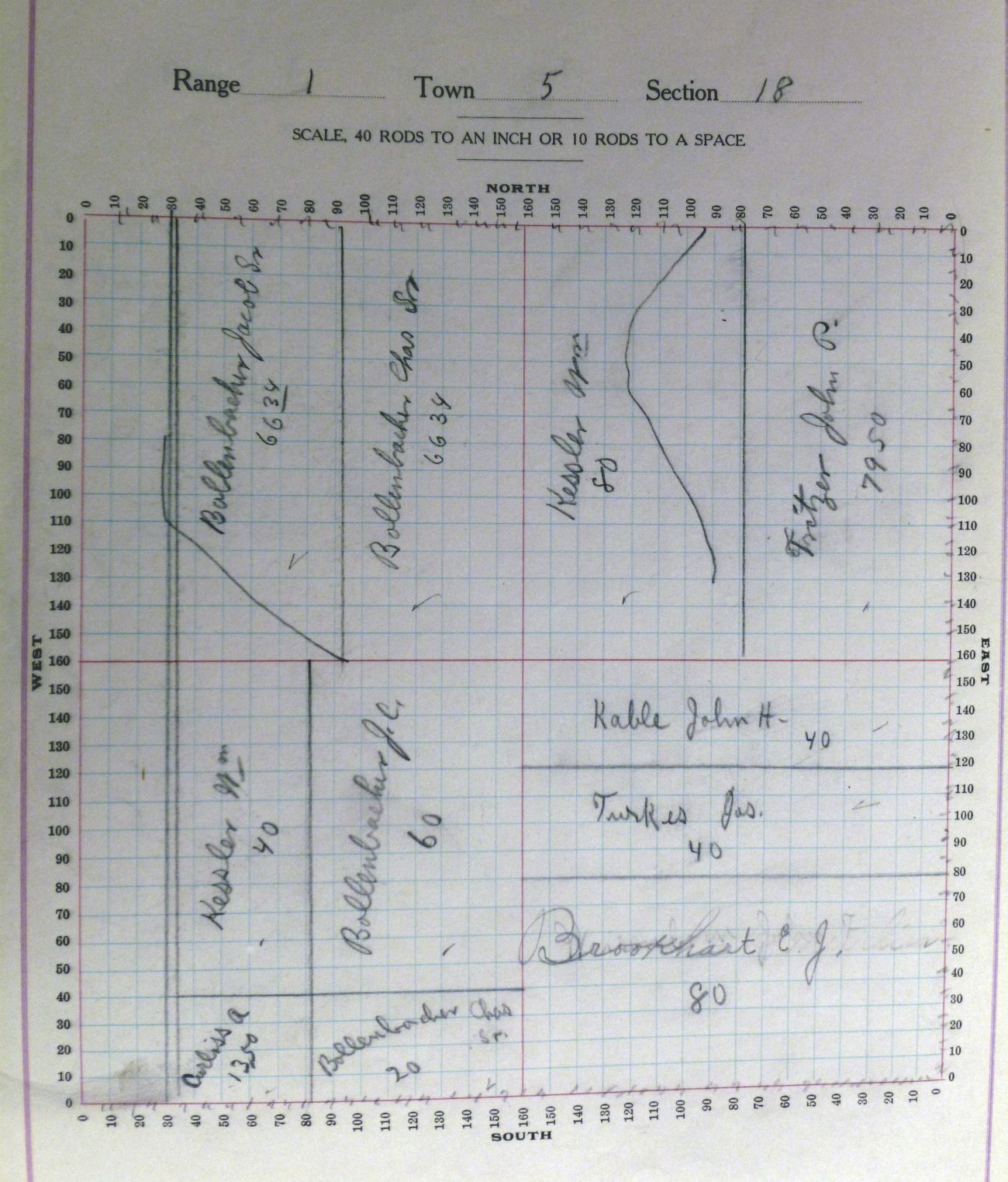
Section 18, Liberty Township, 1914 Appraiser’s Plat Book.
I hope you enjoy looking at the 1914 Liberty Township plat maps and that you locate some of your ancestors on the them.

4 comments
Skip to comment form
Found the family farm in Section 6. Lots of Bechers in this township. I know that George and William were a great help to my great grandmother Rose Schlenker Becher after her husband passed away. At age 35 she was left with her mother-in-law and 3 young daughters to care for as well as run the farm for 13 years until Ted Leininger married her daughter Carrie. Thanks so much for the wonderful information.
Author
Glad you found them and thank you for the additional family information.
Hi Karen,
I’ve been told the Brehm Post Office sat south of the St. John’s Lutheran Church cemetery on Wabash Road. I’ve seen a couple maps pointing to the location, but where it shows it on the maps isn’t where I have heard it actually sat. Since our family owns the property south of the cemetery I am curious of the exact location. Was it on church property or farm ground? I believe the years it was in service would have been 1890-1897. We recently had an old barn torn down, and I have doubt it was ever a post office. But, it may have been the location it sat on. I don’t have a clue where to begin, as I haven’t found a map that old. Any suggestions?
Author
I looked at the 1888 map and there was a “store” on Philip Kable’s property in Section 9. From that map it appears the store would have been on the west side of the road, about half way between the church and Oregon Road. I bet the post office may have been in that store. Maybe one of the readers knows for sure. It would be interesting to know! Thanks for writing.